Protecting the Coast: Uniting Ancestral Memory and Mangrove Ecosystems for Disaster Resilience
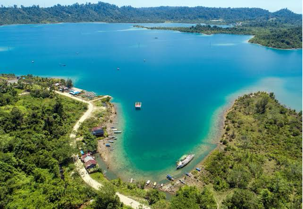
Simeulue island coastal landscape (Photo Credit : Kompas Regional)
Indonesia’s position along the Pacific "Ring of Fire"—where the Indo-Australian, Eurasian, and Philippine Sea plates meet—makes its vast archipelagic coastline one of the most seismically active zones on Earth. Home to millions of inhabitants across more than 80,000 kilometers of shorelines, the nation lives in constant exposure to underwater earthquakes, land subsidence, severe ocean surges, and tsunamis.
For years, disaster management has heavily relied on automated early-warning technology and hard engineering structures such as concrete seawalls. However, history and environmental science demonstrate that physical infrastructure alone is rarely enough. True long-term coastal resilience requires integrating two deeply interconnected pillars: community cultural memory and functional coastal ecosystems.
The Social Dimension: Cultural Memory and Lessons from Simeulue
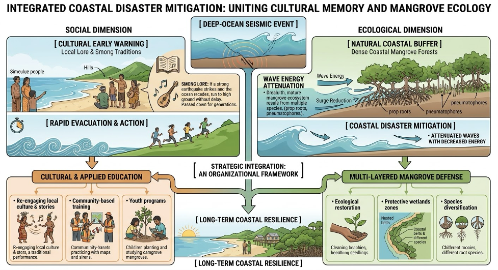
An infographic illustrating how cultural memory (Smong) and mangrove ecological buffers work together to mitigate tsunami risks (Photo Credit : AI-generated conceptual diagram)
During the devastating 2004 Indian Ocean Tsunami, which claimed hundreds of thousands of lives across the region, the island of Simeulue—located near the earthquake’s epicenter off the coast of Aceh—experienced an extraordinary survival rate. Among a population of over 70,000 people, fewer than ten casualties were recorded as a direct result of the tsunami.
This remarkable resilience was not driven by digital sensors, satellite feeds, or automated siren towers, but by Smong—a traditional body of oral lore passed down through generations following a catastrophic tsunami that struck the island in 1907.
- Rapid Mobilization: The lore of Smong provided a simple, unambiguous protocol: if a strong earthquake shakes the island and the ocean rapidly recedes, run to high ground immediately without waiting to gather belongings or seek official confirmation.
- Embedded Cultural Transmission: By weaving life-saving lessons into lullabies, poems, songs, and informal storytelling during everyday community gatherings, this knowledge remained active across generations.
- Speed Over Technology: In 2004, this collective memory triggered an instant evacuation within minutes of the initial tremors, outperforming modern electronic alert systems that require time to process and transmit official warnings.
The Ecological Dimension: Mangrove Hydrodynamics and Coastal Defense
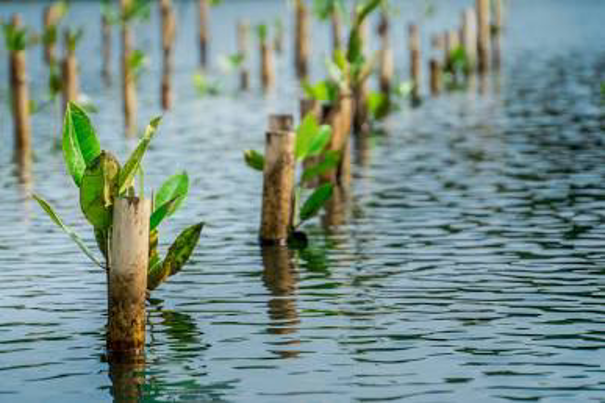
Mangrove ecosystem abd shoreline (Photo Credit : Jejakin)
If traditional wisdom acts as an instantaneous "mental alarm system," mangrove forests serve as nature's frontline physical defense. Dense mangrove systems act as natural, living breakwaters, mitigating wave energy through complex hydrodynamic processes:
- Wave Energy Attenuation: Complex root networks (such as prop roots in Rhizophora and vertical pneumatophores in Avicennia) create high hydraulic resistance. As ocean waves enter dense mangrove stands, friction rapidly dissipates kinetic energy, significantly reducing wave height and flow velocity within the first 100 meters of forest.
- Surge Mitigation & Flow Reduction: Dense foliage and trunk structures absorb impact energy and distribute incoming tidal surges across vast wetland basins, lowering inundation depth and preventing high-velocity water from rushing inland unchecked.
- Sediment Trapping & Shoreline Stabilization: Intricate root matrices trap fine sediments, bind coastal soil, and reduce erosion caused by daily wave action, preserving the structural integrity of natural shorelines and buffering coastal infrastructure.
Strategic Integration: An Organizational Framework for Coastal Management
Building genuine long-term resilience requires moving beyond rigid concrete seawalls or isolated technological solutions. Sustainable coastal protection requires an integrated strategy that combines ecological restoration with community-based capacity building.
|
Strategic Pillar |
Core Action |
Operational Focus |
|
Ecological Restoration |
Multi-Layered Mangrove Defense |
• Restoring native mangrove species across historical intertidal zones. • Establishing multi-tiered vegetation buffers combining pioneer and inland species. • Protecting existing mature wetlands from coastal development and clearing. |
|
Community Engagement |
Cultural & Applied Education |
• Integrating local cultural knowledge and storytelling (Smong) into formal and informal disaster education. • Conducting practical, field-based training for early evacuation protocols. • Empowering local coastal communities to manage, monitor, and maintain local ecosystems. |
Conclusion
Sustained coastal safety depends on treating ecological buffers and community awareness as mutually reinforcing systems. Restoring mangrove forests builds the natural physical shield, while empowering coastal communities through ancestral collective memory ensures rapid, decisive action when disasters strike. Nature and humanity must work hand in hand to protect our coasts for generations to come.