Land Sink and Rob Flood in Demak Regency, a Dual Challenge for the Coastal Community
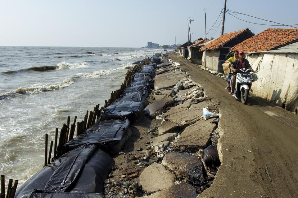
Photo Credit : M Ibnu Chazar
Demak is a coastal regency located in the northern part of Central Jawa Province, Indonesia. Recently this area facing dual threats of rob floods and land subsidence, which pose significant risks to the community’s well being and sustainable development.
Land sinking, also known as land subsidence, refers to the gradual sinking of the earth’s surface. This situation is not only happened in Demak, but also in other countries such as Venice-Italy, Mexico City-Mexico, and yes, Jakarta-our Indonesia’s capital city. These countries have been facing long battled issue of land subsidence, as a result of excessive groundwater extraction for the increased demand for water. In Demak’s case, land subsidence is primarily caused by the relentless pumping of groundwater for agricultural and industrial purposes. This resulted to gradually sinks of the land above and worsening the region’s vulnerability to flooding.
Rob floods have become an unfortunate reality for the people of Demak. The low -lying coastal topography of Demak makes this city prone to flood. These floods often occur during hight tides or heavy rainfall, causing widespread damage to infrastructure, homes, and agricultural fields.
The land subsidence and rob flood phenomenon have made severe socio-economic and environmental impact to the coastal community. Agricultural and pond-farming, as it is the main activities of community, have suffered due to saltwater intrusion and the loss of fertile soil. Thus, affect farmer livelihoods and food security.
GIS-Coastal has started the initiatives to undertake proactive measure to mitigate the challenges by the activities as follow:
-
- Mangrove Conservation and Reforestation : GIS-Coastal has launched the extensive mangrove rehabilitation project aiming to restore and expand mangrove ecosystem along vulnerable coastal areas.
- Community Empowerment and Preparedness : educating local communities in disaster preparedness, and empowering community to utilize ponds for mangrove planting area and exploring economic opportunities through pond harvesting.
By implementing these proactive measures, engaging local community and stakeholders, we can work hand in hand overcome the challenges together and forge a path towards a more resilient, sustainable, and prosperous coastal future for generations to come.